Conference Overview & Program
Welcome to Pecora 20.
With emphasis on recent significant developments in remote sensing, the theme of Pecora 20 is “Observing a Changing Earth: Science for Decisions…Monitoring, Assessment, and Projection.” This conference will offer a program on applications of satellite and other Earth observations to monitor, assess, and perform projections of future land and water resources, as well as big data and other analytical technologies to improve decision making utilizing satellite data.
The Pecora Symposium series was established by the USGS and NASA in the 1970s as a forum to: 1) foster the exchange of scientific information and results derived from applications of Earth observing data to a broad range of land-based resources; and 2) discuss ideas, policies, and strategies concerning land remote sensing.
Pecora 20 Preliminary Program
Keynote Speaker –
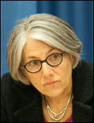
Barbara J. Ryan – Secretariat Director of the intergovernmental Group on Earth Observations (GEO)
Ms. Ryan is the Secretariat Director of the Intergovernmental Group on Earth Observations (GEO) in Geneva, Switzerland. GEO is comprised of 104 Member States, the European Commission, and 109 international scientific and technical partner organizations. Since becoming Director of GEO in 2012, Ryan has worked to integrate Earth observation systems from around the world into a single, comprehensive system that uses coordinated data to understand how environmental factors impact human life. Prior to her work at GEO, she was the Associate Director for Geography at the USGS, where she was responsible for the agency’s remote sensing, geography and civilian mapping programmes, including the Landsat satellites. It was during this time she led the effort to change the decade-old Landsat data policy to full and open, an action resulting in more than 42 million scenes being downloaded globally to date. Ryan has served as chair of the international Committee on Earth Observation Satellites, which coordinates information from more than 100 civilian satellite missions, and in 2008, became director of the World Meteorological Organization’s space programme. Ryan has been awarded an honorary doctorate of science degree from SUNY Cortland. She was recently named an Honorary Fellow of the American Geographical Society, and in January 2017, was one of 10 global leaders to be named to the Geospatial World Forum’s Hall of Fame.
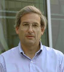
Michael H. Freilich – Director, Earth Science Division at NASA Headquarters
Dr. Freilich is the Director of NASA’s Earth Science Division. The purpose of NASA’s Earth science program is to develop a
scientific understanding of Earth’s system and its response to natural or human-induced changes, and to improve prediction of climate, weather, and natural hazards. A major component of NASA’s Earth Science Division is a coordinated series of satellite and airborne missions for long-term global observations of the land surface, biosphere, solid Earth, atmosphere, and oceans. This coordinated approach enables an improved understanding of the Earth as an integrated system. Prior to coming to NASA, he was a Professor and Associate Dean in the College of Oceanic and Atmospheric Sciences at Oregon State University. He received BS degrees in Physics (Honors) and
Chemistry from Haverford College in 1975 and a Ph.D. in Oceanography from Scripps Institution of Oceanography in 1982. Dr. Freilich’s honors include the JPL Director’s Research Achievement Award (1988), the NASA Public Service Medal (1999), and the American Meteorological Society’s Verner E. Suomi Award (2004), as well as several NASA Group Achievement awards. He was named a Fellow of the American Meteorological Society in 2004.
Harry A. Cikanek – Director (acting), STAR – Center for Satellite Applications and Research
Harry is the acting Director for the United States National Oceanic and Atmospheric Administration’s Center for Satellite Applications and Research (STAR), the unit of the NOAA Satellite and Information Service responsible for transforming raw and intermediate satellite data flows from NOAA and global observing system satellites into real time weather and environmental data and information products. These feed forecast models, and operations personnel in the National Weather Service, National Ocean Service, National Marine Fisheries Service, and support research, and long term environmental information products to meet NOAA’s and its partner weather and environmental information needs to protect life, property and livelihoods.
Prior to this assignment, Harry served just over five years as the first Director of the NOAA Joint Polar Satellite System (JPSS). His
major JPSS accomplishments included stabilizing and streamlining the program to tighten its focus on the weather mission while avoiding over $2 billion in cost. He oversaw the successful transition of the Suomi National Polar Partnership (the first JPSS mission) satellite to NOAA operations and its continued successful operations in support of the NOAA weather mission. Harry began his career as a NASA aerospace engineer. His 30 years at NASA included engineering and program management in rocket propulsion, launch services, space transportation technology, and human exploration of space. He served at both the NASA Glenn Research Center and Marshall Space Flight Center contributing to a diverse array of programs including Space Shuttle Main Engine, Evolved Expendable Launch Vehicle, Advanced Space Transportation Program, Orion, and several robotic science and technology missions and flight experiments. He is the author or coauthor of over 25 papers and articles. He is also a recipient of the Presidential Rank of Meritorious Executive, the NASA Outstanding Leadership Medal, and is an Associate Fellow of the American Institute of Aeronautics and Astronautics.
Samuel N. Goward – Research Professor/Emeritus Professor, University of Maryland
Dr. Goward pursues biophysical applications of land remotely sensed data. He has been actively involved in the land observation missions since the 1970s, specifically focused on Landsat and AVHRR. His recent research has focused on evaluating North American forest disturbance and regrowth from the historical Landsat observation record for the North American Carbon Program (NACP). He currently is serving as a member of the NACP science steering group. He served as the Landsat Science Team Leader for Landsat 7 and continues as a member of the Landsat Science Team today. In addition he served as the Co-Chair for the USGS National Land Satellite Land Remote Sensing Data Archive (NLSLRSDA) advisory committee. In recognition of his long-standing commitment to land
observations and the Landsat mission, Dr. Goward has received the USGS John Wesley Powell award, the USGS/NASA William T. Pecora award and the ASPRS SAIC Estes Teaching award. He continues to serve as an associate editor for Remote Sensing of Environment.
Curtis E. Woodcock – Professor of Earth and Environment, Boston University
Dr. Woodcock has held academic positions at the University of California, the City University of New York and Boston University. His
primary research interests are: the use of remote sensing to monitor land change, including topics of time series analysis, cloud/cloud
shadow detection, and validation of time series results; terrestrial carbon dynamics; the causes and consequences of land cover and land use change. Dr. Woodcock was the 2016 William T. Pecora Award winner for “outstanding contributions toward understanding the Earth by means of remote sensing.” He currently is co-team leader for the Landsat Science Team.
Mike Warren – Co-founder and CTO, Descartes Labs
Mike Warren is the Co-founder and CTO of Descartes Labs. His past work spans a wide range of disciplines, with the recurring theme of developing and applying advanced software and computing technology to understand the physical and virtual world. He was a scientist at Los Alamos National Laboratory for 25 years, and also worked as a Senior Software Engineer at Sandpiper Networks/Digital Island. His work has been recognized on multiple occasions, including the Gordon Bell prize for outstanding achievement in high-performance computing. He has degrees in Physics and Engineering & Applied Science from Caltech, and he received a PhD
in Physics from University of California, Santa Barbara.
Joe Mascaro – Director of Academic Programs, Planet
Joe Mascaro is a tropical ecologist and Director of Academic Programs at Planet, a San Francisco-based aerospace
company that operates the largest fleet of Earth-imaging satellites. Joe works with universities and individual investigators to utilize Planet’s unprecedented imaging resources to enhance primary research and education, improve
forest monitoring and conservation, expand food security, and promote ecological resilience for some of the world’s most vulnerable communities.
Dr. Valerie Pasquarella
Dr. Valerie Pasquarella works at the intersection of remote sensing and ecology, using time series of satellite imagery to improve mapping and monitoring of landscape dynamics. She is currently a Postdoctoral Research Associate with the DOI Northeast Climate Science Center and the Department of Environmental Conservation at the University of Massachusetts Amherst. Having lived and worked in Southern New England for over a decade, Dr. Pasquarella actively collaborates with a number of local research groups and land management agencies, and her research has strong regional ties. Ongoing projects include using Landsat time series to improve forest composition mapping and near-real-time monitoring of gypsy moth defoliation. She is also interested in time series approaches to mapping early successional habitat and invasive plant distributions, with a long-term goal of utilizing all available Landsat observations to advance understanding of multi-scale multi-species interactions over large spatial extents.
Todd Hawbaker – Research Ecologist
Dr. Todd Hawbaker is a research ecologist at the USGS Geosciences and Environmental Change Science Center in Lakewood, CO.
Prior to joining USGS in 2008, he pursued his graduate work at the University of Wisconsin – Madison. His research focuses on ecosystem disturbances, their impacts, and the processes driving them. His most recent work has been to develop an algorithm to identify burned areas using dense time series of Landsat data. Which he and his team have applied to the entire archive for the conterminous United States producing a 32-year data set for monitoring fire patterns and impacts.
Plenary Sessions
- Current state of Earth observations
- Pecora award presentation and panel of recent Pecora award winners discussing progress and challenges in remote sensing
- Trends in big data analytics and progress in using Earth observations
- New breakthroughs in Earth observations and applications
- Click here to view Plennary Sessions
Town Hall Sessions
Landsat 10 User Needs (POC: Zhuoting Wu)
Tuesday, November 14th, 8:00 am to 10:00 am
In this town hall, the USGS will provide an overview of the Landsat 10 user requirements collection process and summary results followed by a
question-and-answer session. The USGS and NASA are working together to develop Landsat 10, scheduled to launch in the 2027 timeframe as part of the Sustainable Land Imaging program. The USGS Land Remote Sensing Program has collected user requirements from a range of applications to help formulate the Landsat 9 follow-on mission (Landsat 10) through the Requirements, Capabilities and Analysis (RCA) activity. User requirements collected through RCA will help inform future Landsat 10 sensor designs and mission characteristics. Current Federal civil community users have provided hundreds of requirements through systematic, in-depth interviews. Academic, State, local, industry, and international Landsat user community input was also incorporated in the process. Emphasis was placed on spatial resolution, temporal revisit, and spectral characteristics, as well as other aspects such as accuracy, continuity, sampling condition, data access and format. This is an opportunity for government, academia, industry users, and data and value-added products providers to learn about the RCA activity and have an open-forum exchange on future Landsat 10 user needs and capabilities.
EROS Data User Group (POC: Rynn Lamb and Raad Saleh)
Tuesday, November 14th, 10:00 am to 12 noon
In early 2018, USGS/EROS expects to launch a new initiative to support
direct engagement with the Landsat and related remote sensing communitythrough formation of an EROS Data User Group(EDUG). The primary purpose of this user group will be to: (1) provideoperational users of Landsat and related products an opportunity andplatform to discuss opinions, needs, and concerns in a structuredmanner; (2) obtain user feedback and input for potentialincorporation into EROS operations to support the continuousimprovement of USGS products and services; and (3) provide for targetedcommunications and direct feedback from selected members of the usercommunity regarding internal development efforts.
Thistown hall session will provide a high-level description of the proposeduser group and allow for input and feedback from the Pecora science andapplications community. Key elementsplanned for discussion include: user group description and mission,justification, roles and responsibilities, membership, communicationmechanisms, and proposed operational flow.
Workshops
The EROS CalVal Center of Excellence (ECCOE) First CalVal
Cross-calibration of Landsat 8 OLI and Sentinel 2 MSI and its impact on data interoperability Click here for more info (PDF, 2.7 MB)
Social Events
Welcome Lunch
Tuesday, November 14th, 12:00 p.m. to 1:00 p.m.
Location: Exhibit Hall 2
Have lunch on us! Come to the Exhibit Hall to visit with the wonderful exhibiting companies in attendance and grab a quick lunch. A great way to begin your Symposium week.
Admission to this event is included with most registrations.
Lunch with Exhibitors’
Wednesday and Thursday, November 15th and 16th; 12:00 p.m. to 1:30 p.m.
Location: Exhibit Hall 2
Take some time out of your busy week and have lunch with Exhibitors. A much needed 90-minute break in the middle of the day will surely refresh you with a complimentary lunch and some good conversation. Take time to meet with our generous exhibiting companies, view posters, and even catch–up with friends.
Admission to this event is included with most registrations.
Refreshment Breaks – Exhibit Hall
Location: Exhibit Hall 2
Each day of the symposium refreshment breaks will be served in the Exhibit Hall. Take a break from the technical track sessions to network, visit the fantastic booths, and grab cup of coffee or soda.
Admission to this event is included with most registrations.
Exhibitors’ Reception
Tuesday, November 14th, 5:30 p.m. to 7:30 p.m.
Location: Exhibit Hall 2
Take
this wonderful opportunity to visit with the national and international
suppliers exhibiting at the Symposium. An ASPRS tradition, the
Exhibitors’ Reception is a perfect time to mingle with
fellow attendees, thank the Conference Exhibitors’, our hosts for the
evening, and stop by to view the wonderful Posters on display and
interact with the authors. The evening is sure to provide a relaxed
environment with light hors d’oeuvres and beverages
and a time to come together with old and new friends.
Admission to this event is included with most registrations.
Geospatial Munch and Meet!
Thursday, November 16th, 12 noon to 1:30 pm
Come have lunch and meet industry leaders in geospatial technologies and sciences! The Early Career Professionals Council, Education and Professional Development Committee, Student Advisory Council, and the Corporate (Sustaining) Members Council have joined forces to bring a fun lunchtime experience focusing on getting to know your peers and learning more about what ASPRS has to offer. During the lunch hour, subject matter experts will give short talks about:
- · Major advancements and innovations in GIS/RS/P science
- · How to become an ASPRS Certified Professional
- · Free and Paid Web Trainings
- · Where to find reference/study material
- · AND MUCH MORE!!
We look forward to joining you for lunch on Thursday. Come prepared to take notes on the presentation to win prizes!