Workshops
Workshops will be held in conjunction with the Pecora 20 Conference all day Monday and Tuesday morning (November 13th and 14th, 2017). All workshops will be half day (approximately 4 hours including mid-workshop break).
Scheduled workshops are below.
Registration for workshops is now open.
- Click here to view the registration page, and log in if not already.
- Scroll down to Additional Registration Options to choose your workshops. Remember to also choose Workshop Discount to receive your first workshop free of charge.
Workshop 1—Monday, November 13th, 1:00 pm to 5:00 pm
SNAP for Sentinel-2
Michael Tuohy, Massey University, NZ
Sentinel-2A and Sentinel-2B are European satellites with a multi-spectral instrument providing 12 bit data for 13 bands: 443 nm – 2190nm. The VNIR bands have a spatial resolution of 10m and the best part is it’s all free! Sentinel-2A has been acquiring data since late 2015 and Sentinel-2B was launched in March, 2017. With both satellites operating, the re-visit time will be 5 days. While the data may be easy to acquire from either the Sentinel Data Hub https://scihub.copernicus.eu/ or the USGS https://glovis.usgs.gov/next , the data structure is a bit tricky to navigate and working with the data may not be as easy as you might think. To ensure that everyone has the ability to use Sentinel data, the European Space Agency commissioned Brockman Consult http://www.brockmann-consult.de/ to develop the Sentinel Application Platform (SNAP). This software is available free for Windows, Mac OS and Unix platforms.
The workshop will introduce you to this amazing software and have you analyzing Sentinel-2 data in no time at all.
Specifically, participants will learn how to:
open Sentinel-2 datasets
reproject to local map projection
subset images
create mosaics
export to other formats
add vector layers
extract pixel values
use the Graph Processing Tool
Sample data for areas close to Sioux Falls will be used in all the exercises.
Participants should bring their own laptops (Windows or Mac OS) and have already downloaded and installed SNAP with its Sentinel Toolboxes from the ESA website http://step.esa.int/main/download/. It is recommended that your laptop has at least 4 GB of RAM.a
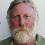
Mike Tuohy is a Senior Lecturer at Massey University, Palmerston North, New Zealand. He has been teaching remote sensing since 1989. His expertise with the ESA SNAP software for analyzing Sentinel data grew from a familiarity with BEAM, its predecessor that enabled the interpretation of data from other European satellites. Mike is a long-time member of ASPRS and has participated in three previous Pecora conferences.
Workshop 2—Monday, November 13th, 8:00 am to12 noon
Object-based approaches to data fusion land cover mapping
Jarlath O’Neil-Dunne, University of Vermont
We are awash in data. From satellite imagery to airborne lidar to crowd-sourced road networks, there is no location on the Earth’s surface that has not been mapped in some shape or form. The current challenge in land cover mapping lies in our ability to integrate these various streams of data in such a way that leverages their strengths while minimizing their weaknesses. This workshop will introduce participants to object-based approaches to land cover mapping that integrate raster, vector, and point cloud datasets into a seamless feature extraction workflow. It is recommended that participants have a strong foundation in remote sensing and GIS, and at least some exposure to OBIA. This workshop is particularly well suited to individuals who are finding it difficult to extract information from the latest generation of high-resolution imaging and LiDAR sensors using OBIA techniques. Specific emphasis will be paid to moving beyond the standard “segment and classify” approach that is typically employed in most OBIA projects, to an iterative workflow that better mimics the type of mapping carried out by human analysts by fully incorporating the spectral, geometric, and contextual information present in an image. Through a series of lectures, demonstrations, and hands-on exercises, participants will be exposed to the methods that will enable them to build effective and efficient OBIA routines.
Demonstrations and exercises will make use of a broad range of remotely sensed (e.g. imagery and LiDAR) datasets and will demonstrate how remotely sensed and thematic datasets can be integrated in an OBIA context. Participants are encouraged to bring their own computers to use during the hands-on exercises. OBIA software will be provided (requires Windows 10 64-bit).
It is recommended that participants have a strong foundation in remote sensing and GIS and be comfortable using desktop geospatial software. No expertise with OBIA techniques is required.
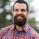 Jarlath O’Neil-Dunne is the Director of the University of Vermont’s (UVM) Spatial Analysis Laboratory. Jarlath is well known for his expertise in object-based image analysis (OBIA). He and his team have employed OBIA techniques to generate over 1 trillion pixels of land cover data. He is currently chair of the Board of Directors of AmericaView.
Workshop 3—Tuesday, November 14th, 8:00 am to12 noon
Accuracy Assessment of Remotely Sensed Data
Kass Green, President, Kass Green & Associates
This course focuses on the theory, principles, techniques, and practical aspects of thematic accuracy assessment. Participants will receive instruction in how to design accuracy assessment procedures, allocate accuracy assessment samples, collect reference data, and analyze results. Examples of both pixel and object based accuracy assessment case studies, based on actual project data will be presented and lessons learned discussed. The course will review commonly used accuracy assessment protocols and will use real world examples to highlight trade-offs between different approaches. Each participant in this course will come away with a solid understanding of accuracy assessment procedures and the knowledge to properly interpret the results. The course instructor is Kass Green, co-author of the widely acclaimed text, Assessing the Accuracy of Remotely Sensed Data: Principles and Practices.
 Kass Green’s experience spans thirty years of leadership in GIS and remote sensing technology, research and policy. She has conducted accuracy assessments for a wide variety of per pixel and object based small and large scale projects based on Landsat, Digital Globe, and high resolution airborne imagery. Ms. Green is an award winning author and is the co-author of the widely acclaimed text, Assessing the Accuracy of Remotely Sensed Data, Principles and Practices with Dr. Russell Congalton. Ms. Green chairs NASA’s Earth Science Applications Committee and is a past member of the Department of the Interior’s National Geospatial Advisory Committee. She is a fellow of ASPRS, a past president of both MAPPS and ASPRS, and the first woman to be awarded ASPRS’s honorary membership award. Ms. Green recently co-authored the upcoming Esri Press’s book, GIS and Imagery, Best Practices for Extracting Information from Imagery which will be published in the Fall of 2017.
Workshop 4—Monday, November 13th, 1:00 pm to 5:00 pm
Proper Care and Feeding of Metadata
Ryan E. Bowe, GISP, Woolpert
Do you feel you are overrun with metadata requests? Does dealing with metadata make you want to “go postal”? With preparation, the care and feeding of metadata maintenance will no longer constitute time-killing drudgery. Several tips and tricks for taming metadata will be presented. After reviewing the different options for geospatial metadata, several key elements of Federal Geographic Data Committee’s Content Standard for Digital Geospatial Metadata will be discussed in detail and also compared to International Organization for Standardization’s 19115 schema. Key sections highlighted in the United States Geological Survey’s LiDAR Base Specification will be a focus. A brief journey into ArcGIS metadata options will occur as well.
Attendees should come to the workshop with questions and specific problems. The goal of the workshop is that attendees depart with a workflow in place to create and maintain their own template.
Attendee Requirements: None, but laptop and sample metadata is encouraged.
 Ryan Elizabeth Bowe, GISP is a photogrammetrist with Woolpert with over 12 years’ experience in the geospatial industry. Ryan successfully manages a large number of airport master plan base mapping and vertical obstruction projects. As geospatial project manager, her experience encompasses all aspects of digital mapping, photogrammetry, surveying, and remote sensing with specialized knowledge of GIS.
Her responsibilities include creation of tens of thousands of metadata files for geospatial datasets, some of which she acquired, edited, documented, and delivered to clients. Co-author of “Avoiding Last Minute Metadata Misery” in ArcNews, she stays active in her profession through URISA and ASPRS.
Workshop 5—Monday, November 13th, 8:00 am to12 noon
Remote Sensing Education, Research and Outreach with the Google Earth Engine
J.B. Sharma, Professor, Institute for Environmental Spatial Analysis, University of North Georgia
The advent of a scalable cloud computing image processing platforms like the Google Earth Engine (GEE) brings unprecedented possibilities for remote sensing education, research and outreach. The powerful capabilities of GEE are accessible using broadband internet using a Google Chrome browser. This workshop will focus on an interactive exploration of GEE capabilities. GEE has a repository of all of publicly available aerial and satellite data and also allows user upload of imagery for analysis. This workshop will begin with a presentation of examples of GEE in remote sensing, research and education, with a particular focus on education, undergraduate research and outreach. This will be followed by hands on activities including the GEE Explorer, data exploration, supervised classification, and an introduction to a GEE-API based coding environment. The workshop will end with a moderated discussion in which the participants will share their thoughts on how GEE may be used in their educational, research and outreach efforts. Curricula developed for remote sensing applications using GEE will be shared with the participants.
All participants should have a Gmail address and need to request a ‘trusted tester’ access to GEE. This will give participants access to the JavaScript coding environment within GEE. Coding experience is not necessary and participants will have activities with modifying existing code. The trusted tester access can be requested from: https://signup.earthengine.google.com/#!/

Dr. JB Sharma is a faculty member at the University of North Georgia (UNG), Department of Physics and in the Institute for Environmental Spatial Analysis. He has been a faculty member at UNG for 29 years and teaches courses in both physics and remote sensing. His research interests are physics and remote sensing education, environmental physics, multisensor remote sensing and automated feature extraction using Object Based Image Analysis techniques. He is currently vice-chair of the Board of Directors of AmericaView.
Workshop 6—Monday, November 13th, 1:00 pm to 5:00 pm
Simple is Better. An Intro to Event-Driven Server-less Architectures for Accessing Planetary-Scale Geospatial Data on AWS
Joe Flasher, Amazon
Working with large geospatial datasets has never been easier, thanks to the cloud. When data is made available via services like Amazon S3, you can bring your processing to the cloud instead of downloading the data locally to process it. This shift to democratized access of large processing resources alongside valuable data allows innovative solutions to traditional problems. Large satellite imagery collections like Landsat 8 and Sentinel-2 are made freely available through the Amazon Web Services’ Earth on AWS initiative (https://aws.amazon.com/earth) for anyone to query, analyze or build services on top of.
This workshop will show how, without concern for the details of servers and storage, you can use small amounts of code to quickly build powerful solutions, in this case a disaster response pipeline. The workshop will walk you through an end to end process including 1) creating highly-queryable indexes in real-time from satellite imagery source updates, 2) deploying tooling to monitoring https://earthquake.usgs.gov/ for high-magnitude earthquakes, 3) responding to high-magnitude earthquakes by querying and collecting the most recent, relevant satellite imagery, and 4) responding to high-magnitude earthquakes by running machine learning on imagery over affected areas and determining potential damage estimates. Services used will include Amazon S3, SNS, Lambda, AWS Batch and datasets available at https://aws.amazon.com/earth.
Participants will need AWS accounts to be able to fully participate in the exercises. The session will be using the AWS Command Line Interface as well as the AWS Management Console to deploy and configure services.
Requirements: Participants will need AWS accounts to be able to fully participate in the exercises as well as computers with internet connectivity to access AWS services. An AWS account can be obtained at https://aws.amazon.com/free/.

Joe Flasher is the Open Geospatial Data Lead at Amazon Web Services helping organizations most effectively make data available for analysis in the cloud. The AWS open data program has democratized access to petabytes of data, including satellite imagery, genomic data, and data used for natural language processing. He has been working with geospatial data and open source projects for the past decade, both as a contributor and maintainer. He is a member of the Landsat Advisory Group and has worked on projects ranging from building GIS software to making the space shuttle fly. His background is in astrophysics, but kindly requests you don’t ask him any questions about constellations.
Workshop 7—Tuesday, November 14th, 8:00 am to12 noon
The State of Earth Observation Using Synthetic Aperture Radar Technology and Data
Dr. Yong Wang, East Carolina University
Today, there are many successful studies in which SAR data are used as the primary data source. Examples include global/national land use and land cover, national land survey, agriculture, forestry, fishery, resource exploitation, environmental protection and monitoring, disaster prevention and mitigation, and national security. Therefore, the objectives of this workshop are to present an overview of the state of earth observation using synthetic aperture radar (SAR) with the focus on the current and future development of SAR hardware and processing and analysis software for acquired SAR data using eye-opening applications of SAR and interferometric SAR (InSAR) techniques and datasets. This is a newly developed workshop of a half-day. The course outline is
Fundamentals of radar, synthetic aperture radar (SAR), interferometric SAR (0.5 hour)
Current and operational airborne and spaceborne SARs (0.5 hour)
The state of airborne and spaceborne SAR hardware (1 hour)
The state of airborne and spaceborne SAR software (1 hour)
Eye-opening applications using SAR and InSAR techniques and datasets (1 hour)
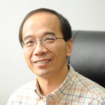 Professor Yong Wang obtained his Ph.D. from University of California, Santa Barbara. He is with the East Carolina University and University of Electronic Science and Technology of China. His research interests in synthetic aperture radar (SAR) and application include the investigation of scale and scale effect on SAR application to urban target delineation, and evaluation of surface deformation using interferometric SAR (InSAR) techniques.
Workshop 8—Tuesday, November 14th, 8:00 am to12 noon
Demystifying the ASPRS Certification Exam
Robert Burtch, Ferris State University
INTERMEDIATE Workshop: Assumes participants have subject knowledge and are serious about taking the Certification Exam.
The purpose of this workshop is to prepare individuals who are planning to sit for the ASPRS Certification exams as a Certified Photogrammetrist or Certified Mapping Scientist in either Remote Sensing, GIS, Lidar, or UAS. The workshop will begin by explaining the purpose and form of the exam. It will then identify key topical areas that an applicant should be aware of prior to taking the exam. Topics will start with a review of the basic concepts and sample questions to show how they will be tested for on the exam. Finally, the workshop will try to identify resources in which exam takers should be aware of and study from in their preparation for the examination.
Topics include: (I) Purpose of the exam (role of the exam in the certification process; format of the exam; topical areas covered on each of the five different exams), (II) Geodesy/Surveying (principles of State Plane Coordinates; surveying technologies; resources for further study), (III) Remote Sensing (important principles; utilization of Remote Sensing for geospatial purposes; review questions; resources for further study), (IV) Geographic Information Systems (important principles; cartographic/mapping concepts; review questions; resources for further study), (V) Photogrammetry (overview of photogrammetric principles; mapping concepts; example exam questions; resources for further study), (VI) Lidar (working principles; utilization of lidar in geospatial science; typical questions one might expect; resources for further study), (VII) Unmanned Autonomous/Aircraft Systems (basic UAS configurations/functionality; overview of regulatory factors; review questions; resources for further study), (VIII) Other topical areas of importance in preparation for the exam.
 Robert Burtch is a Professor Emeritus at Ferris State University in the Surveying Engineering program where he was primarily responsible for teaching Photogrammetry and Remote Sensing along with other surveying courses. In the mid 1980’s he began teaching GIS within the undergraduate surveying program. Bob is a Professional Surveyor in Michigan and Certified Photogrammetrist (Ret.). He has been involved in the certification program since the mid 1990’s as a reviewer, exam question writer and workshop presenter.
Workshop 9—Monday, November 13th, 8:00 am to12 noon
Introduction to ISR Data Formats and Metadata Standards for GEOINT
Jason S. Smith, PhD, Harris Corporation
The FGDC’s Content Standard for Digital Geospatial Metadata (CSDGM) has been a staple of the commercial and civilian GIS market since its publication in 1998. However, the military and intelligence communities did not adopt CSDGM for their Intelligence, Surveillance, and Reconnaissance (ISR) needs. Have you ever wondered what body of geospatial data formats and metadata standards these entities work with? Have you wondered what sort of correspondences there may be between these two worlds?
This workshop will provide an introduction to many of the open ISR data formats and metadata standards used by U.S. DoD, IC, and the NATO Allies, and provide insight into the governmental and international standards bodies that govern these standards, specifications, and guidelines.
Topics being discussed include:
Still Imagery Data Formats and Supporting Metadata Structures
Motion Imagery Data Formats and Supporting Metadata Structures
Security Portion Marking Metadata requirements
Controlled Unclassified Information marking metadata
Profile Development activities
Certification & Testing resources
Collaborative Experiment in data format and metadata creation – common pitfalls to avoid and best practices to emulate Attendee Requirements: laptop is encouraged.
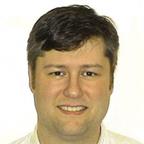 Dr. Smith is an Image Scientist with Harris Corporation who has worked with ISR-related data formats and metadata standards for 20 years. He is an active member of the U.S. National Imagery Transmission Format Standard (NITFS) Technical Board (NTB), the U.S. Motion Imagery Standards Board (MISB), the NATO STANAG 4545 Custodial Support Team (CST), and supported the creation of the Open Skies Digital Data Exchange Format (OSDDEF) for use by the international Treaty on Open Skies. He has authored imagery product data format specifications for several airborne imaging systems and has experience with the data/metadata requirements for various elements of the National System for Geospatial-Intelligence (NSG). Dr. Smith received his doctorate in Imaging Science from the Rochester Institute of Technology (RIT) and he is an ASPRS member from the Central New York region currently serving as the Region Officers Council (ROC) chairperson.
Workshop10—Tuesday, November 14th, 8:00 am to12 noon
Cloud-based Spatiotemporal Data Analysis using Google Earth Engine
Xingong Li, University of Kansas
Google Earth Engine (GEE) is a cloud-based geospatial processing platform for planetary-scale environmental analysis which combines Google-scale data storage and processing power. This workshop assumes some familiarity with Earth Engine and showcases its capability through hands-on sessions where attendants will work through some scripts that are used in global environment and climate trend analysis.
The workshop consists of two parts. The first part is a short review of the basics of Earth Engine and lets the attendants visually explore land cover/use change using global Landsat imagery available on Earth Engine. The second part will cover the fundamentals of Earth Engine data analysis framework and its application programming interfaces (APIs) using snow cover analysis as an example. Attendants will write JavaScript scripts to calculate snow cover frequencies at different temporal scales and analyze global snow cover frequency trends at 500-m resolution using more than 16 years of daily MODIS snow products available on Earth Engine.
All participants should have a Gmail address and should have ‘trusted tester’ access to GEE. This will give participants access to the Java Script coding environment within GEE. It is possible for those taking the workshop on Remote Sensing, Research, Outreach and Education using Google Earth Engine would then take this workshop to gain more experience. The trusted tester access can be requested from: https://signup.earthengine.google.com/#!/
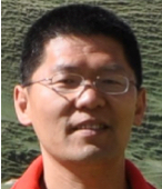 Dr. Xingong Li is a professor at the Department of Geography and Atmospheric Science, University of Kansas. His research focuses on spatiotemporal data analysis and GIS/RS applications in hydrology and water resources management. Dr. Li received a Google Earth Engine faculty research award and has been using Earth Engine since 2014.

